Tocht Stappen Le Garn - rando de la maladerie ruine de la Madeleine  - Photo

rando de la maladerie ruine de la Madeleine

 Lucien84
Lucien84

Gebruiker

© OpenStreetMap contributors
Lengte
Lengte
16,5 km
Max. hoogte
Max. hoogte
403 m
Positief hoogteverschil
673 m
Km-Effort
Km-Effort  
25 km
Min. hoogte
Min. hoogte
55 m
Negatief hoogteverschil
534 m
Boucle
Boucle
Neen
Datum van aanmaak :
2022-06-06 09:41:04.847
Laatste wijziging :
2022-07-02 04:32:33.869

(0 Bericht)

Stappen
Stappen
6h18
Moeilijkheid : Zeer moeilijk

Scan deze QR-code om de tocht te openen in de SityTrail-applicatie

Gratisgps-wandelapplicatie

Logo SityTrail SityTrail

IGN / Geografische instituten

SityTrail uit de App Store downloaden SityTrail uit Google Play downloaden

Logo SityTrail SityTrail World

De wereld gaat voor u open

SityTrail uit de App Store downloaden SityTrail uit Google Play downloaden SityTrail op Huawei AppGallery downloaden

Over ons

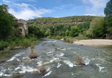
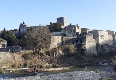
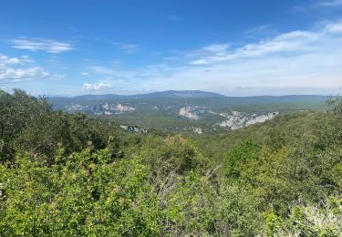
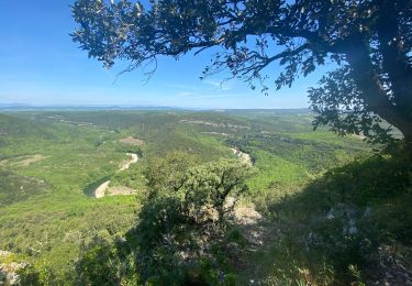
Tocht Stappen van 16,5 km beschikbaar op Occitanië, Gard, Le Garn. Deze tocht wordt voorgesteld door Lucien84.
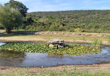
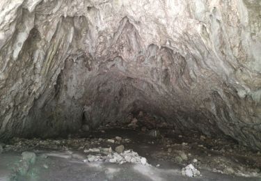
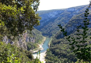
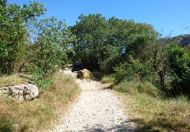
Beschrijving

Gorges de l'Ardèche

Hoogteprofiel

Plaatsbepaling

Land:
France
Regio :
Occitanië
Departement/Provincie :
Gard
Gemeente :
Le Garn
Locatie:
Unknown
Vertrek:(UTM)
617502 ; 4906613 (31T) N.

Wandeltochten in de omgeving

Tocht Stappen Le Garn - le garn - Photo
Stappen
losjo

Stappen

Medium
(1)
Le Garn, Occitanië, Gard, France
16,6 km | 25 km-effort
7h 54min
Ja
Tocht Stappen Montclus - Montclus - Photo
Stappen
PhilippeetEvelyne

Stappen

Medium
(1)
Montclus, Occitanië, Gard, France
6,3 km | 9,6 km-effort
1h 36min
Ja
Tocht Stappen Montclus - montclus - Photo
Stappen
toinou30

Stappen

Medium
Montclus, Occitanië, Gard, France
17,8 km | 26 km-effort
6h 13min
Ja
Tocht Stappen Le Garn - Le Garn à l’Ardeche - Photo
Stappen
GUIDE
Roger Philippe Wallez

Stappen

Zeer moeilijk
Le Garn, Occitanië, Gard, France
17,7 km | 26 km-effort
7h 4min
Neen
Tocht Stappen Montclus - Montclus petite boucle.  - Photo
Stappen
aitkhedache

Stappen

Gemakkelijk
Montclus, Occitanië, Gard, France
9,7 km | 14,1 km-effort
5h 56min
Ja
Tocht Stappen Le Garn - Gorges de l'Ardèche  - Photo
Stappen
GUIDE
nadinebondoux

Stappen

Moeilijk
Le Garn, Occitanië, Gard, France
17,8 km | 26 km-effort
5h 59min
Ja
Tocht Stappen Montclus - montclus le dent de serret - Photo
Stappen
Vero7684

Stappen

Medium
Montclus, Occitanië, Gard, France
15,7 km | 23 km-effort
4h 50min
Ja
Tocht Stappen Saint-Remèze - Gorges de l'Ardèche - bivouac de Gournier - Photo
Stappen
GUIDE
Orcal37

Stappen

Gemakkelijk
Saint-Remèze, Auvergne-Rhône-Alpes, Ardèche, France
3,2 km | 6 km-effort
55min
Ja
Tocht Stappen Saint-Remèze - 180625 EnCours - Photo
Stappen
randodan

Stappen

Heel gemakkelijk
Saint-Remèze, Auvergne-Rhône-Alpes, Ardèche, France
15,7 km | 23 km-effort
6h 40min
Neen


Sluiten
Mijn abonnementen